
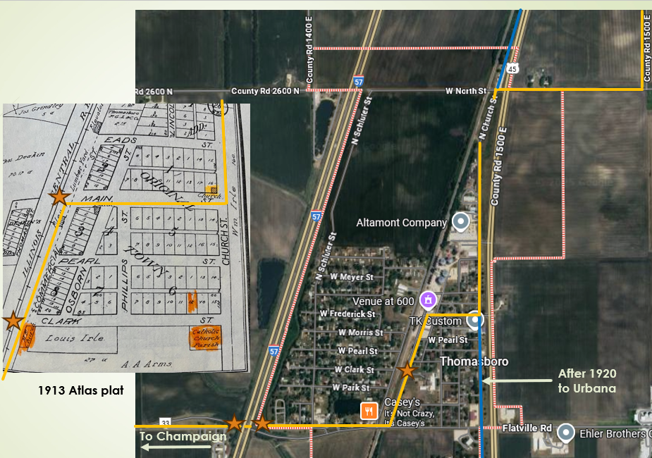
Using details on maps and in newspaper accounts from the era, here’s what I believe to be the route the Egyptian Trail took through Champaign County, starting in the north at the Ford County line and traveling south. The route is overlaid on sections from Google maps with the yellow lines following the original 1915-19 alignment and blue lines showing the changes made after 1920. Orange stars mark locations of photos taken by the author, along with some historic photographs from the Egyptian Trail era.
Ford County Line to Rantoul
Reversing the description that appeared in the Courier (August 30, 1915, in Part One), we find the original trail alignment entering Champaign County three miles directly south of Paxton on what is now CR 1900 E. It continued south another mile, then turned west toward Ludlow on the present CR 3500 N/County Highway 9.
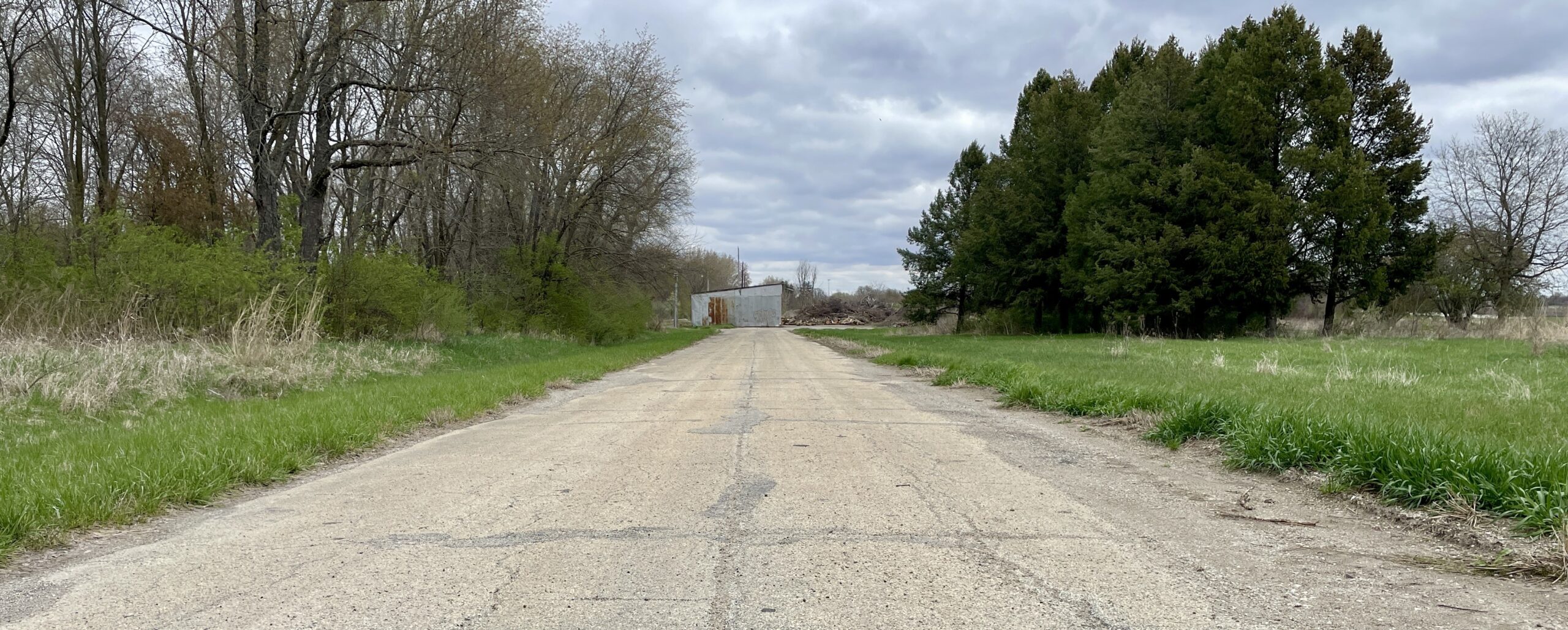
Around 1920, a new paved alignment that paralleled the Illinois Central tracks was built between Paxton and Thomasboro. Remnants of much of that road, later State Route 25 and then U. S. Route 45, and still be seen. Pictured at left is a section looking south from the Ford County line toward Ludlow.
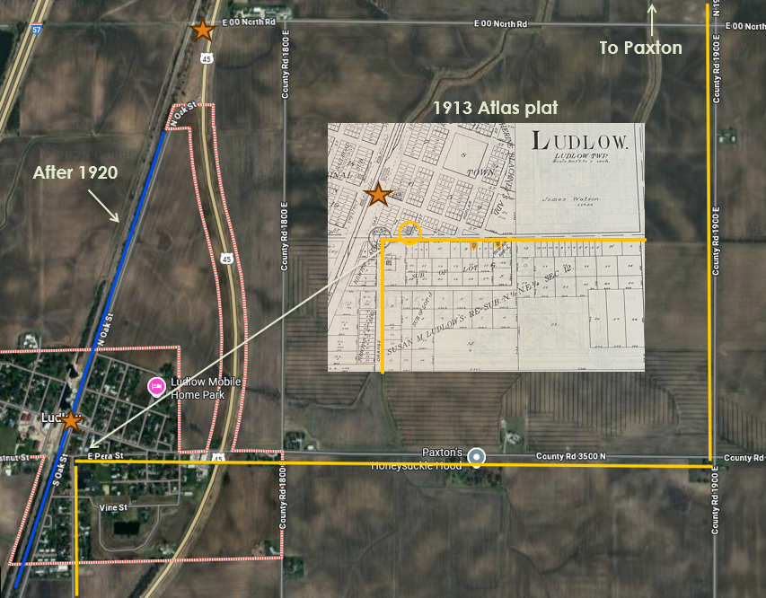
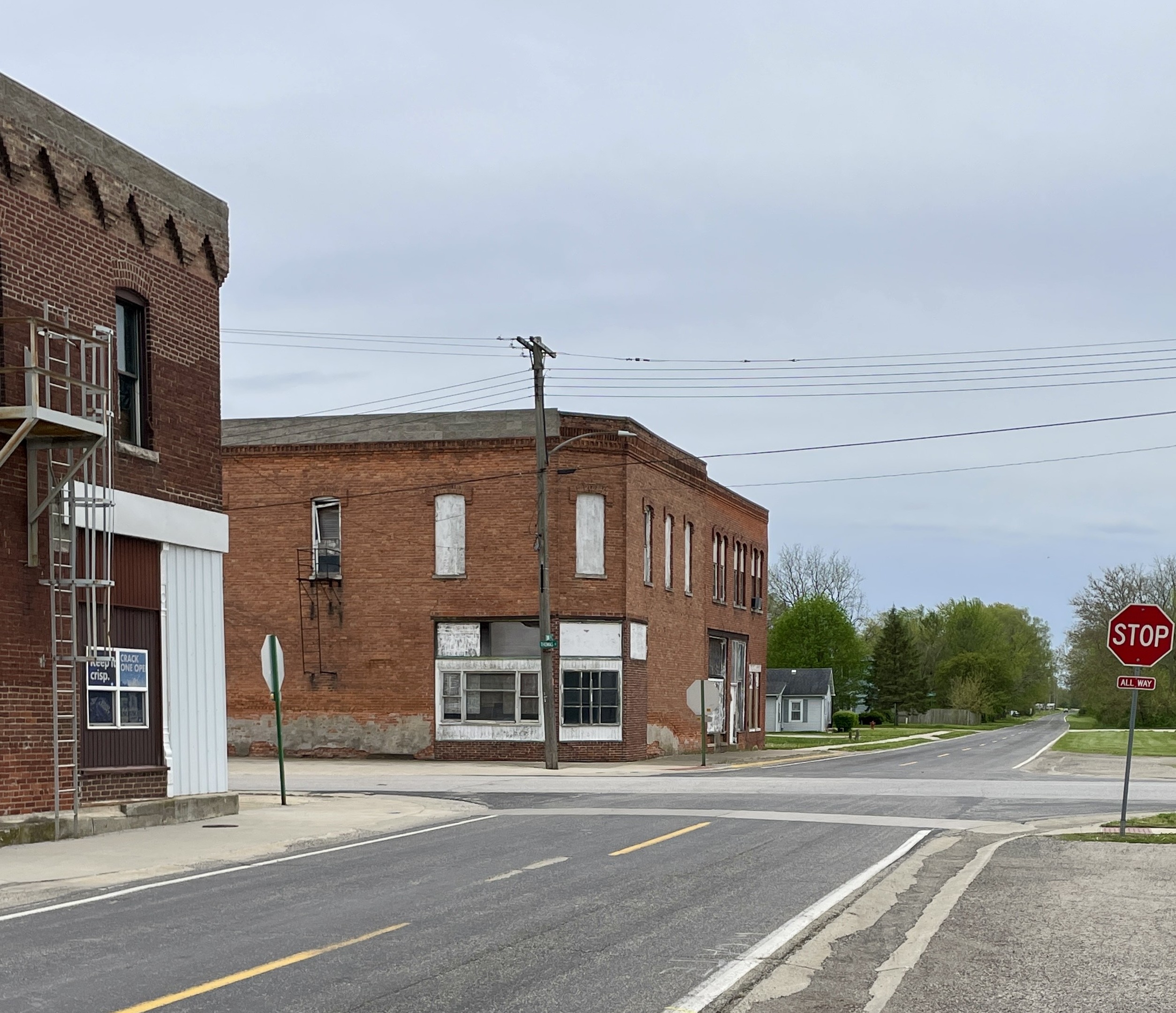
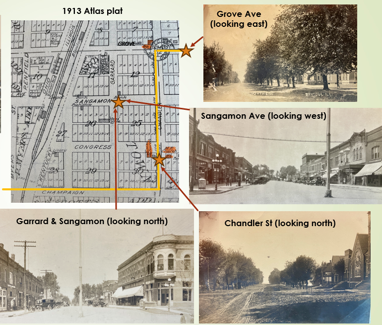
After one and one-half miles, the original route entered Ludlow on Pera Street and then turned south “at the L. N. Bear store.” A commercial building shown on a 1913 Atlas plat at the northwest corner of Pera and Locust (circled), just before the trail turned south on Orange Street, may have been Bear’s store. The Champaign Daily News (October 12, 1898) reported that Bear would be building “a two story brick business block” one block north of the building “he now occupies” that would greatly improve “the appearance of Ludlow’s business section.” That business block now anchors Ludlow’s downtown.
The trail headed south out of Ludlow on Orange Street (CR 1750 E) for one mile, turning west at the property owned by one “R. Corbitt” (hence the “Corbitt road” referenced in the Courier description in Part One). In one-half mile it crossed the railroad and came to a “T,” where it turned briefly south and then crossed back across the tracks before continuing south.
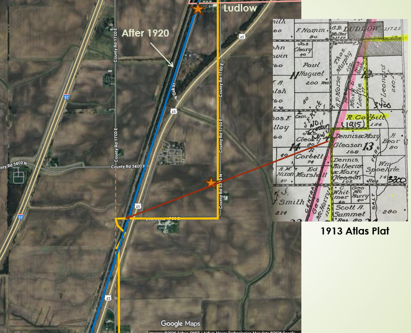
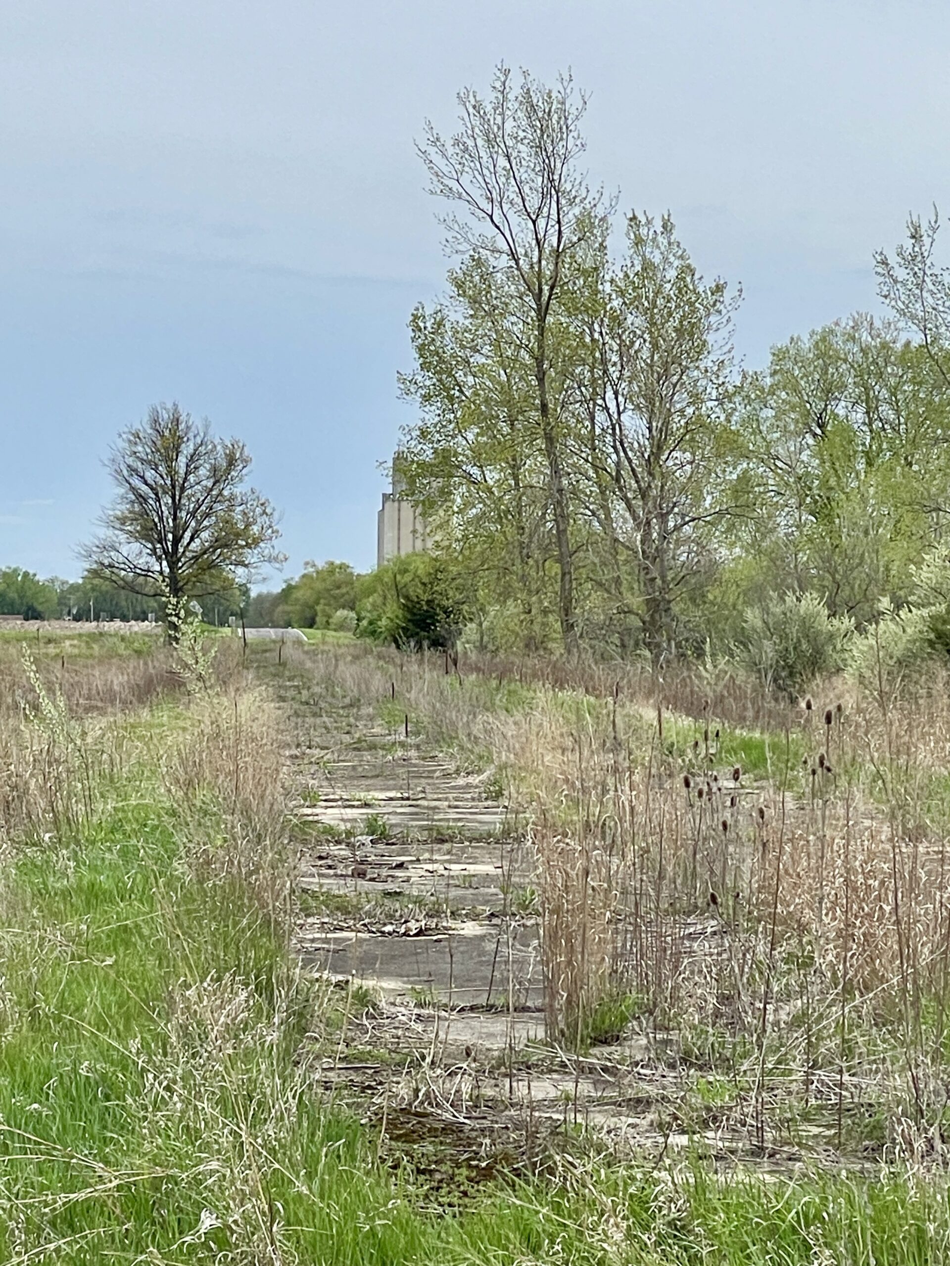
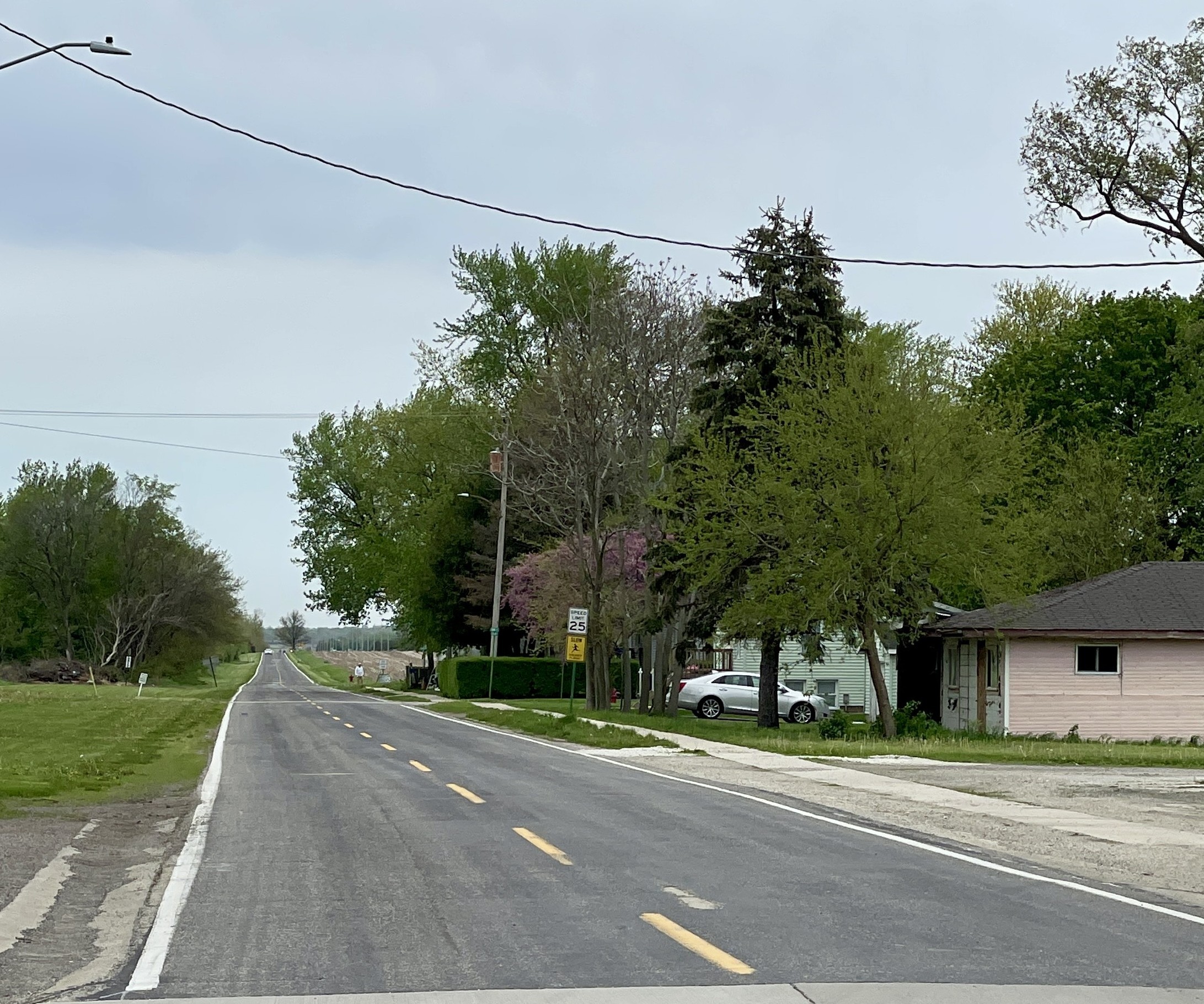
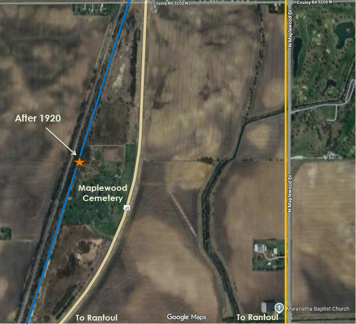
The north-south stretch of road between present CR 3400 N and U. S. 45 is no longer there, nor is the odd double railroad crossing. The original alignment picks back up where CR 1700 E veers south from U. S. 45. Three and one-half miles south on 1700 E/County Highway 55 (Maplewood Drive, below), the trail went west into Rantoul along what is now U. S. 136 (Grove Avenue). After 1920 the new paved route followed the ICRR tracks. A short intact section (right) can be found in Maplewood Cemetery north of Rantoul.
Rantoul to Champaign
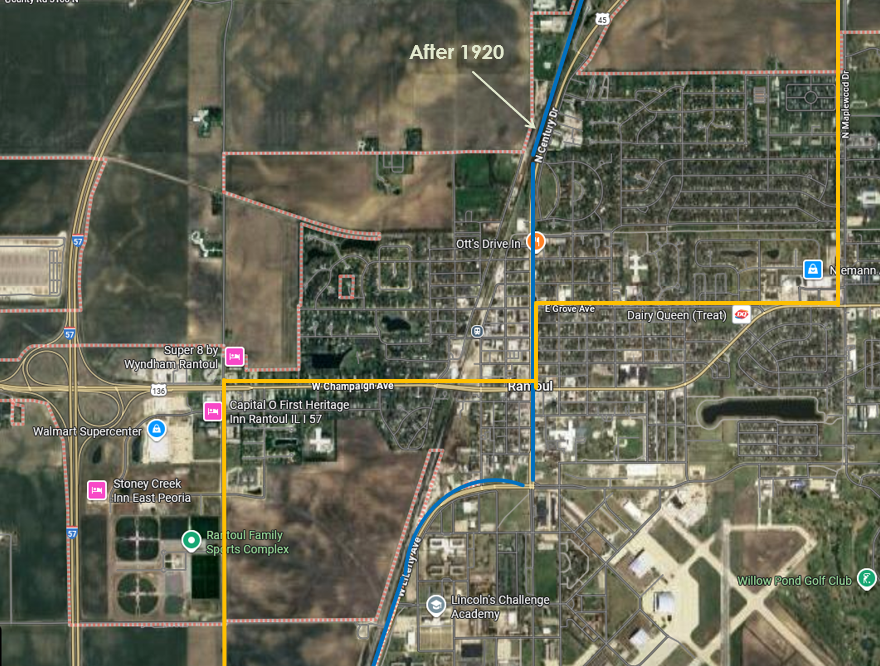
The trail’s original route through Rantoul came in from the east on Grove Avenue, turned south on Chandler Street (now Century Blvd./U. S. 45), went west on Champaign Avenue, across the ICRR tracks, then headed south on what is now Murray Road/CR 1500 E. The 1920 realignment continued south on Chandler, following the same basic route out of town that U. S. 45 now takes.
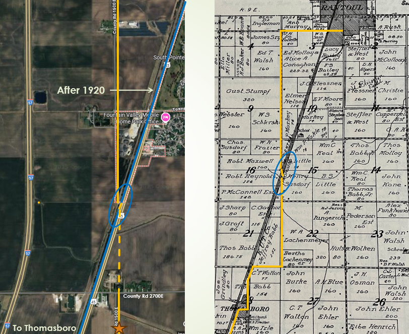
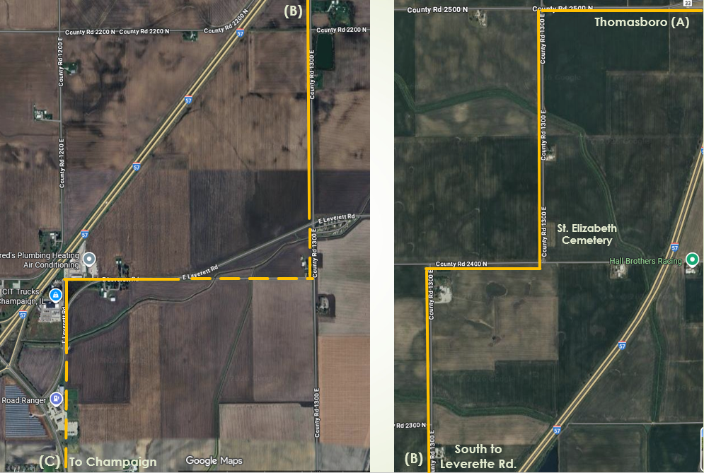
Two and one-half miles south of what is now U. S. 136 in Rantoul, the original trail route crossed the ICRR tracks and continued straight south for another mile and a half. That crossing (on what is now Murray Road/CR 1500 E) is still there( blue circle), but it now terminates at U. S. 45. The short bit of road that used to continue south to CR 2700 N is no longer there, but the old alignment along 1500 E remains between 2700 N and 2600 N. The trail went west at 2600 N for one-half mile back to the tracks, then turned south into Thomasboro on north Church Street.
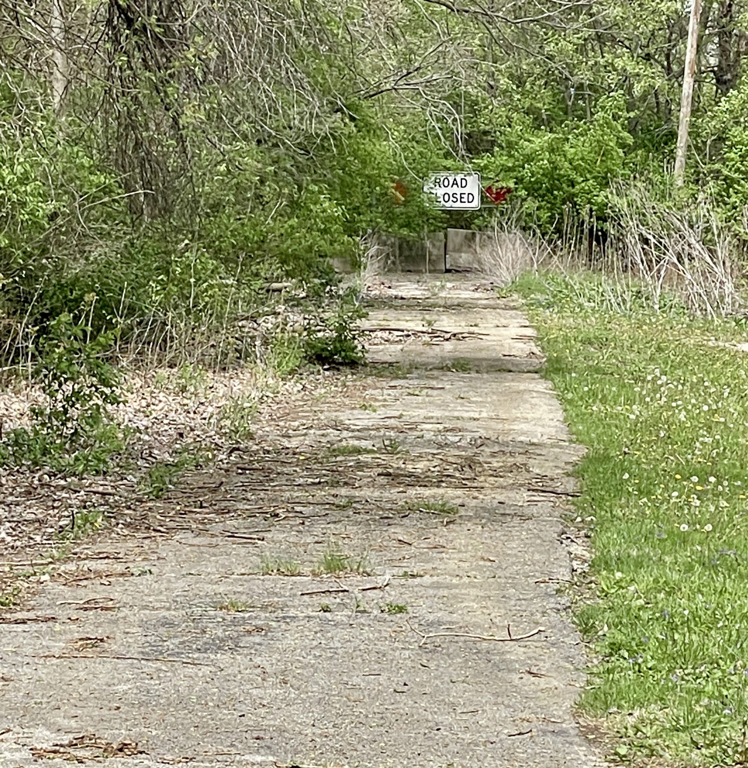
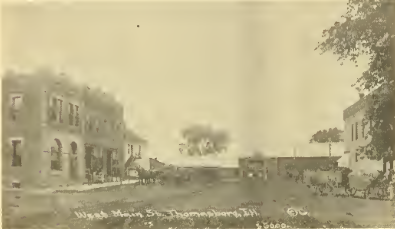
At Main Street in Thomasboro, the trail went west to Commercial Street, then south “past the Kelso and Fiedler stores” and along the east side of the ICRR tracks to Central Avenue. Here it turned west, crossed the tracks, and headed out of town for just over a mile. Where Central Avenue in town now ends at Interstate 57, old paving and a small concrete bridge remain from the early Route 25 days. More old paving is still intact on the west side of the interstate on what is now a small residential spur off of CR 2500 N/County Highway 33.

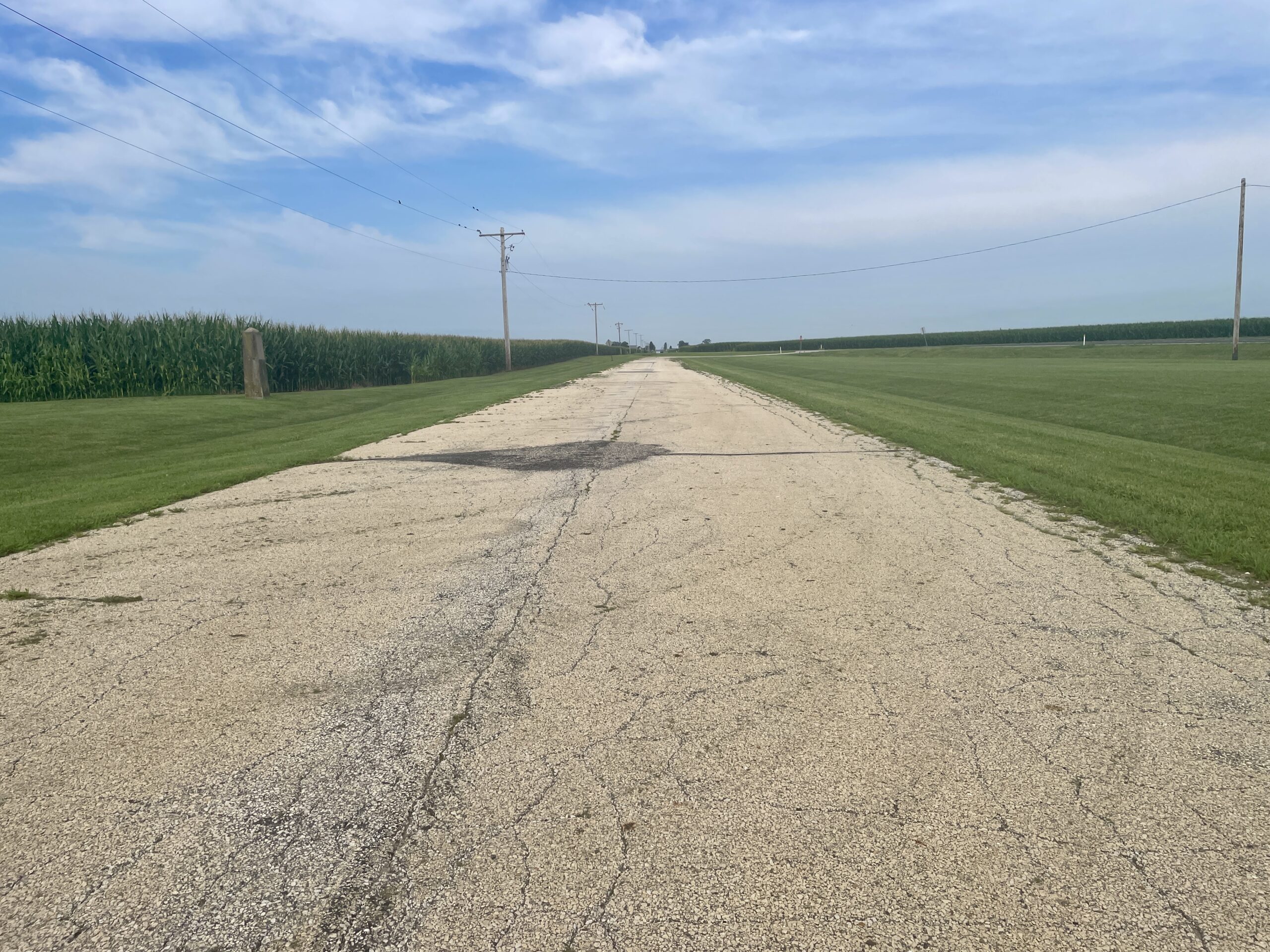
The photos below show the remaining early pavement along the original trail route at the western end of Commercial Ave. (left) and then continuing on the west side of Interstate 57 (right). By the time this pavement was laid, the new alignment (now State Route 25/US 45) would have already been shifted directly from Thomasboro south to Urbana.

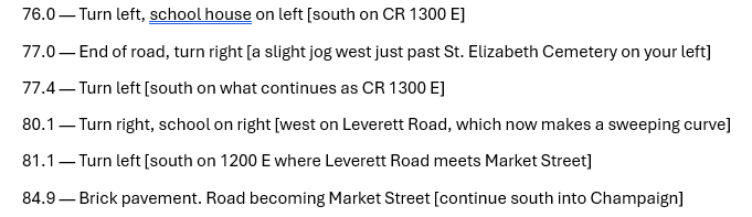
A News-Gazette article (June 14, 2015) commemorating the 100th anniversary of the Egyptian Trail included an account of the trail’s route from Thomasboro to Champaign. It came from an unnamed “automobile guide” with mileage indicators marking the distance from Kankakee. Heading west out of Thomasboro, here’s the route to Champaign (I’ve added current road designations and landmarks in brackets):
In the next concluding segment of our tour of the Egyptian Trail, we’ll follow the route into Champaign and on south through Savoy, Tolono, Pesotum, and on the the Douglas County line. We’ll also take a look at the lasting local legacy of the Egyptian and other early auto trails in Champaign County.