

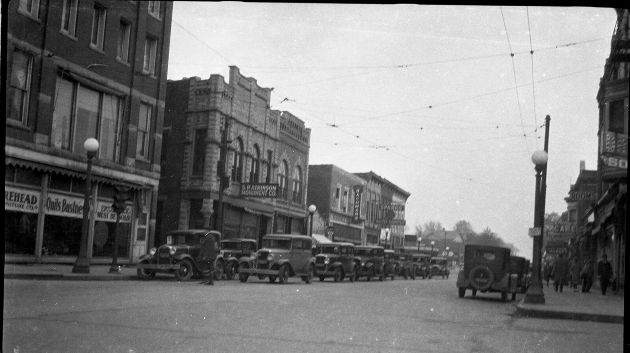
In the last segment of this series we traced the route the Egyptian Trail took through Champaign County from the Ford County line south to Champaign, coming into town on Market Street. At this point the directions an early auto trail guide conclude, “End of [Market] street, turn right on Washington Street. Go one block and turn left on Walnut Street. Turn right on Main Street. Go two shorts blocks to [Neil Street].” Let’s travel through Champaign, sometime around 1917.

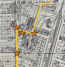
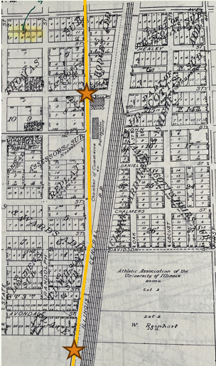
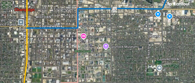
The yellow line on the map traces the original alignment of the trail (1915-19) into and through downtown Champaign. Orange starts mark locations of photographs.
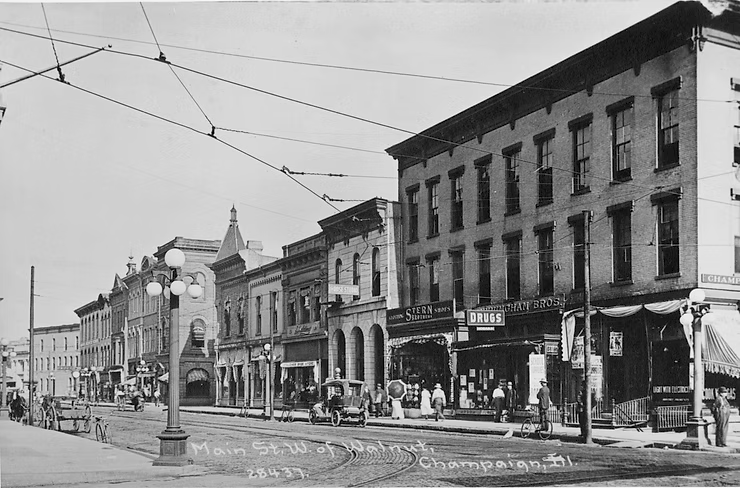
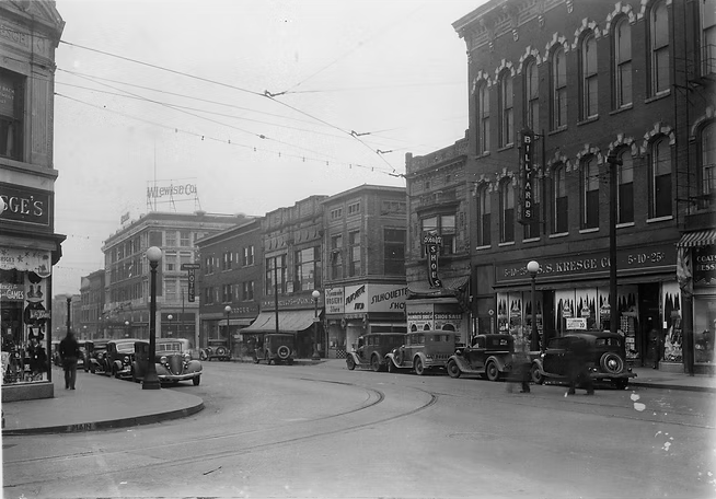
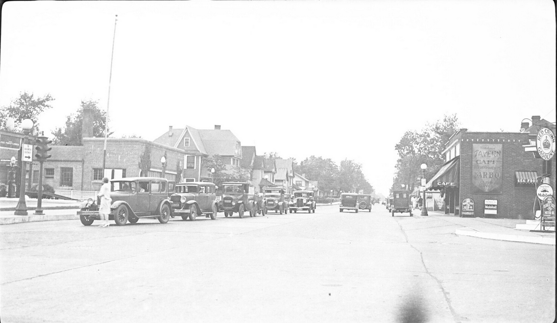
Remember C. A. Kiler, the section vice president behind the Champaign route (Part One of this series)? His home furnishings store located at 24-26 Main Street (pictured right), which the trail did indeed pass just before turning south on Neil to head to Savoy.
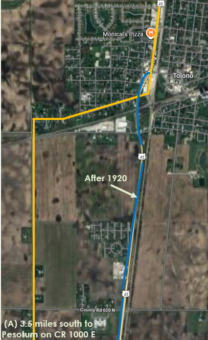
From Champaign the trail ran parallel to the Illinois Central tracks along the same route U. S. 45 travels today, passing through Savoy and entering Tolono on Long Street. Just before the Wabash tracks, the trail turned west out of town on Austin Street, turning south across the tracks on present CR 1000 E.
After crossing the Wabash tracks, the trail proceeded directly south (on present CR 1000 E) for four and one-half miles, entered Pesotum on Elm, turned one block east on present Washington Street and then south on Chestnut through downtown, once again paralleling the ICRR tracks.
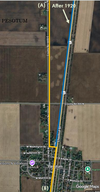
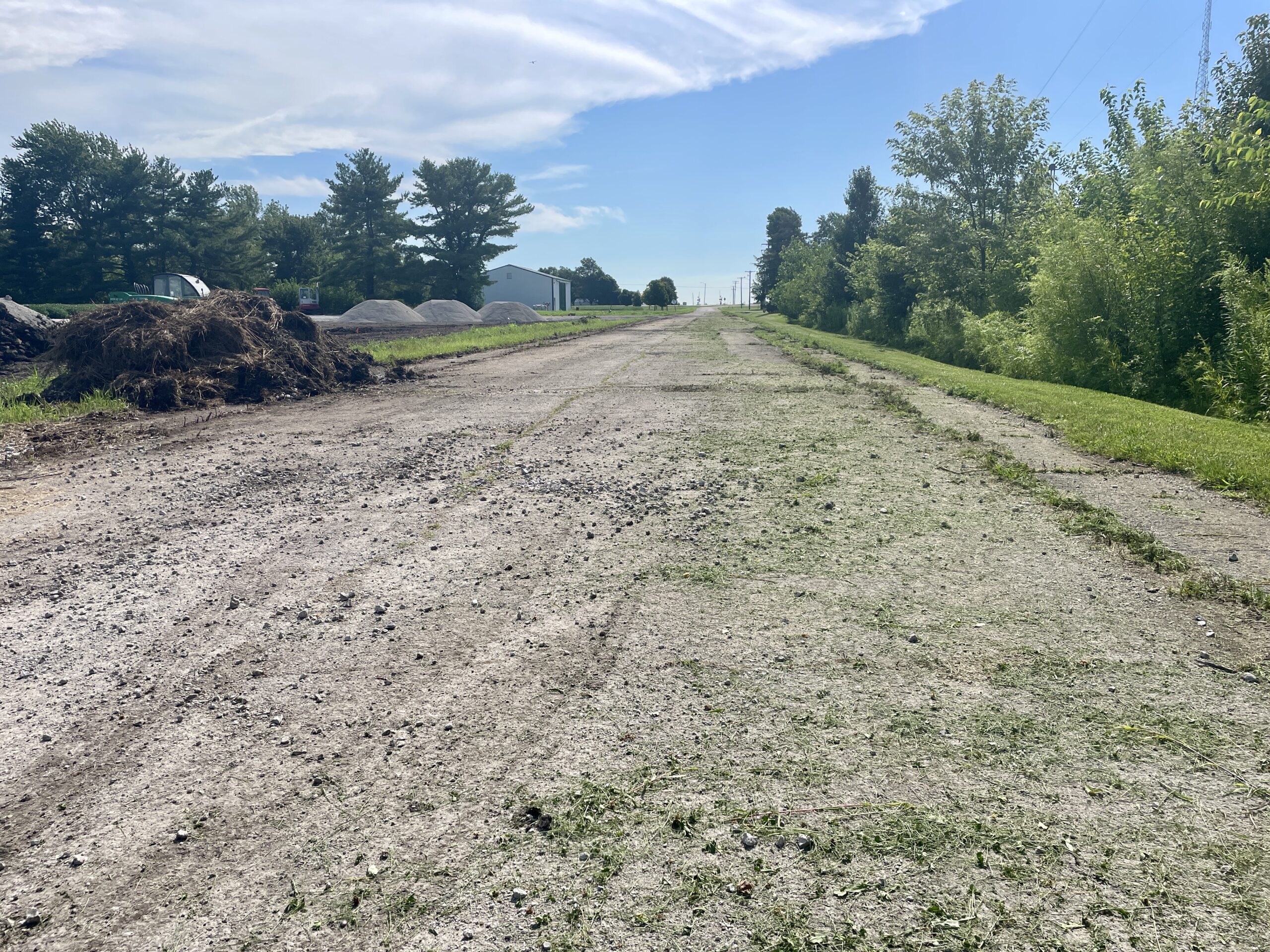
The present sweeping curve heading south out of Pesotum on U. S. 45 toward I-57 was, of course, not there until much later. Chestnut street originally terminated at what is now CR 200 N, and the trail turned west on that road (now just north of the State Police Headquarters). The way west was blocked when I-57 came through, but the road picks back up on the west side of the interstate.
This last bit of the trail through our county can be accessed by continuing south on U. S. 45 through the I-57 interchange, then turning right on CR 900 E coming down from the north. After a mile, the old road curves back east on CR 200E.

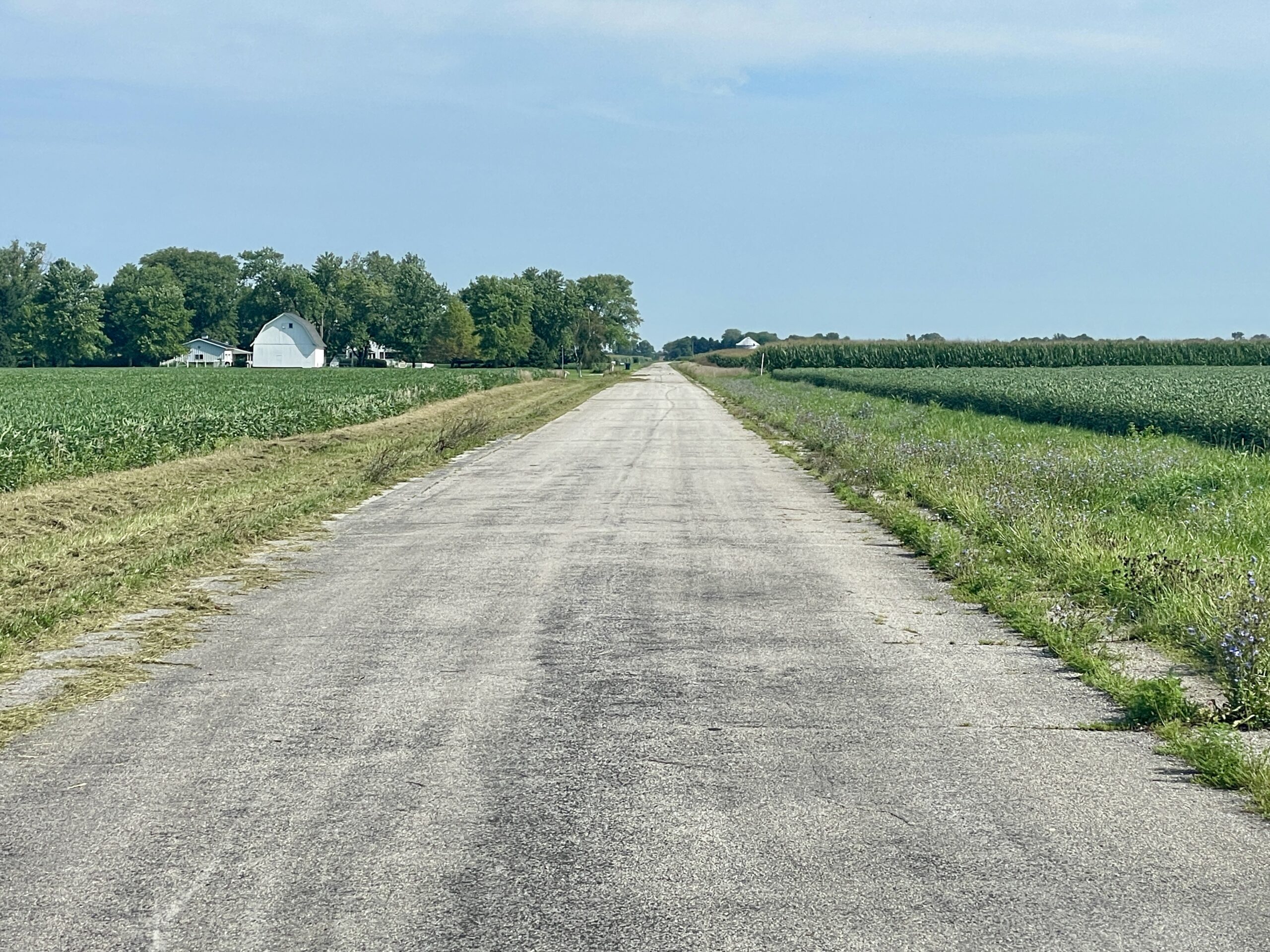
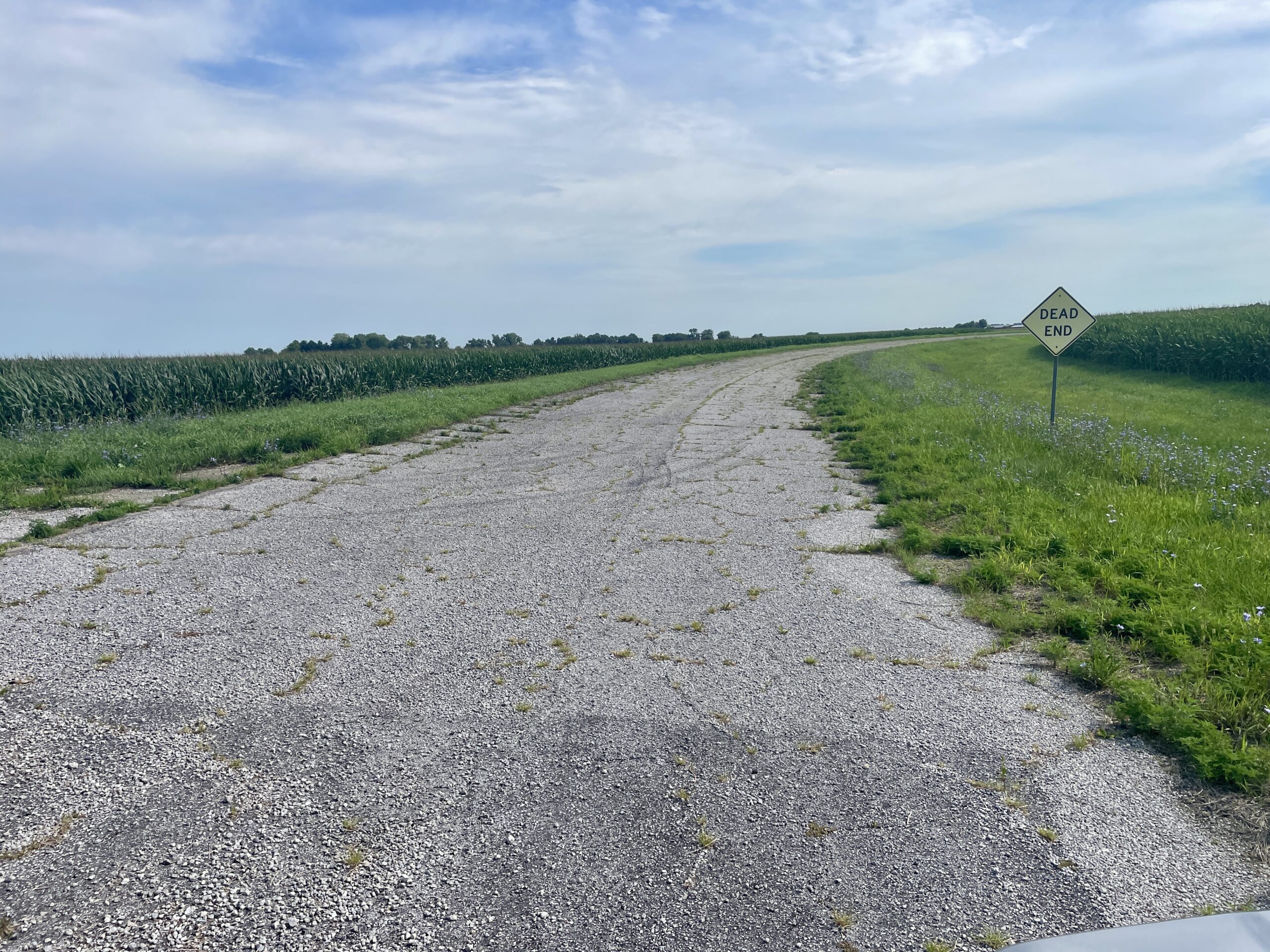
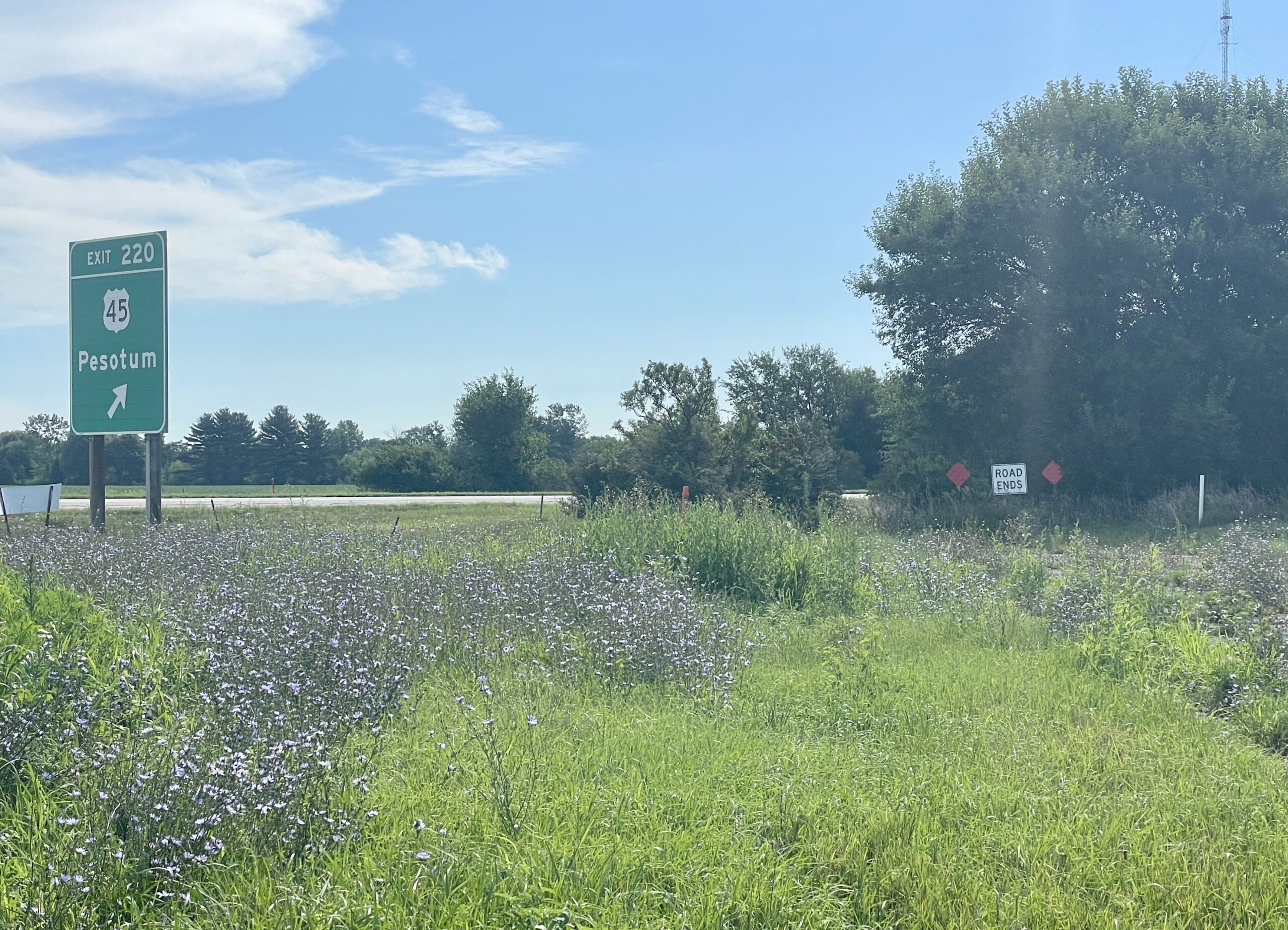
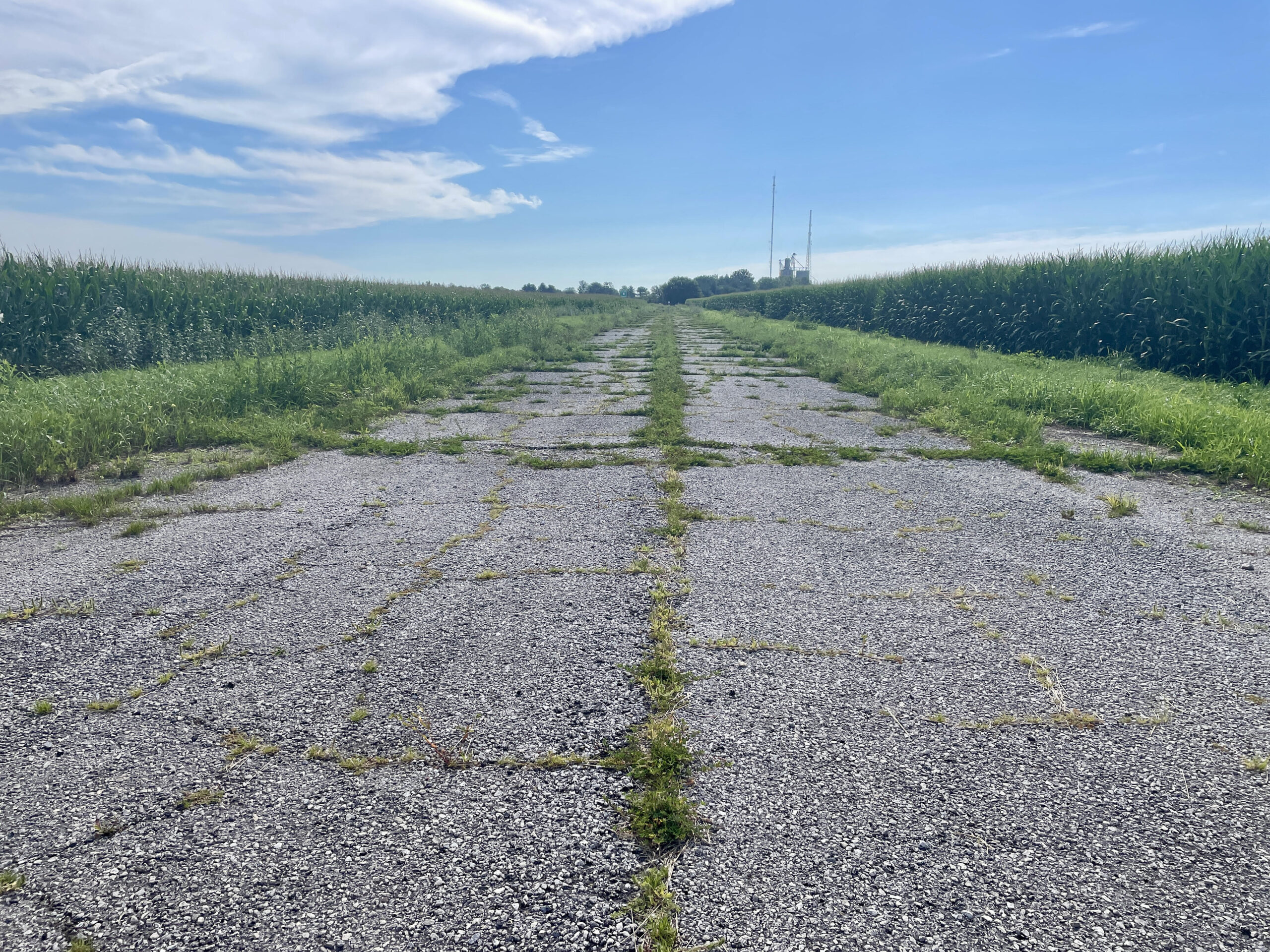
The overgrown paving on this stretch dates back to the early days of State Route 25. Back where CR 900 E joins U. S. 45, the trail continued south on the “hard road” to Tuscola along the route U. S. 45 follows today.
In the next and final segment of this series, we’ll look at the changes that came to the Egyptian Trail and other early auto trails in Champaign County as they transition into state and federal highways and even pave the way for the three interstate highways that meet in Champaign-Urbana.