
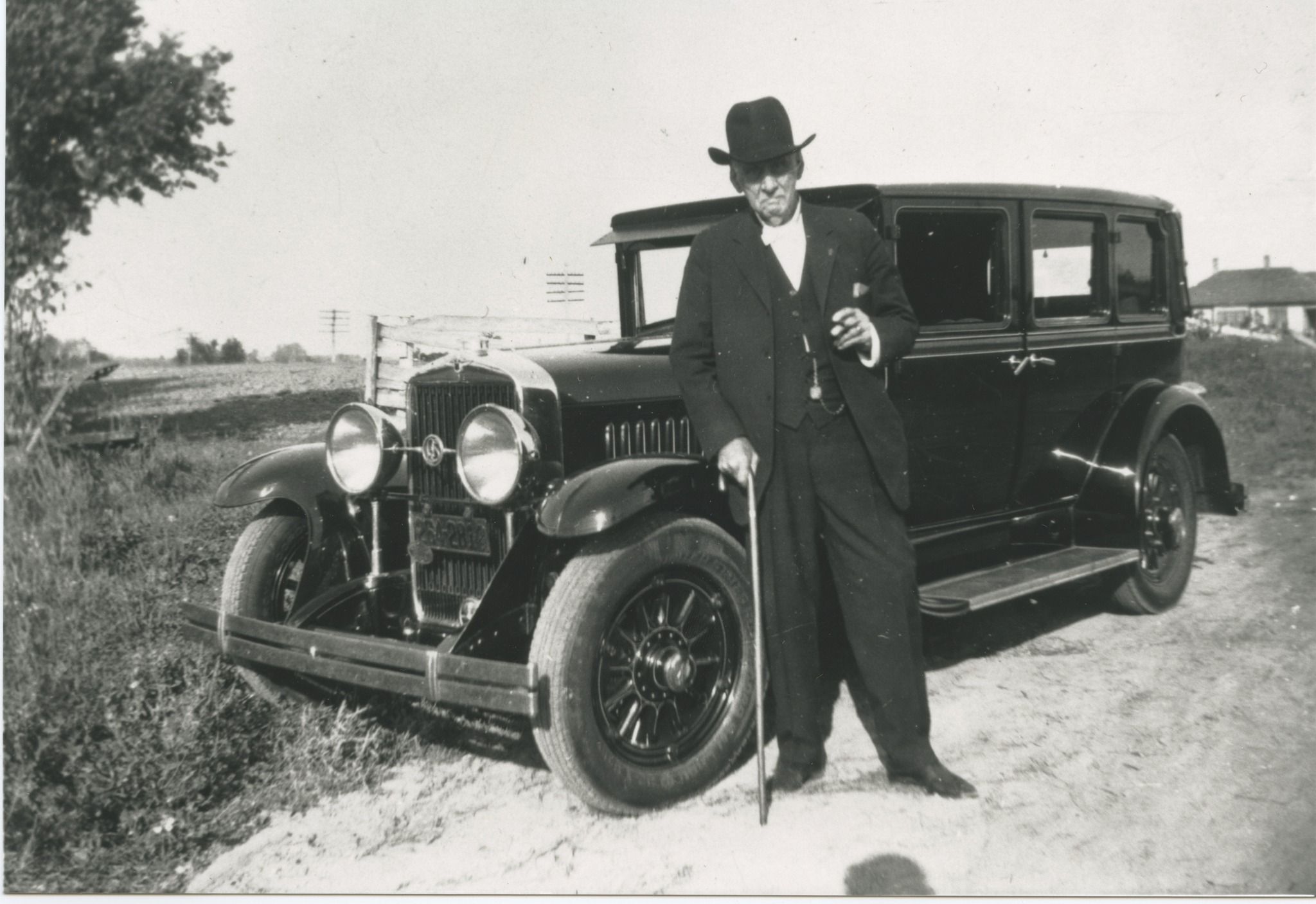
Mattoon dentist and auto enthusiast Iverson A. Lumpkin’s (above) plan for a Chicago to Cairo roadway continues to leave its mark the length of Illinois. From Kankakee to Effingham, travelers on what later became State Route 25 and ultimately U. S. Route 45 are driving on highways made possible by Iverson’s vision.
Champaign may not have wound up as the official terminus city between the northern and central divisions of the Egyptian Trail as originally planned, but it certainly was the focal point where all the early auto trails coming through the county met, as shown on this 1917 Rand McNally Auto Trails map.
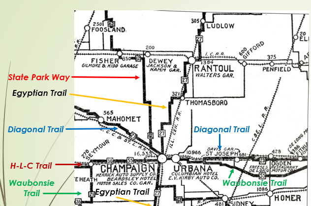
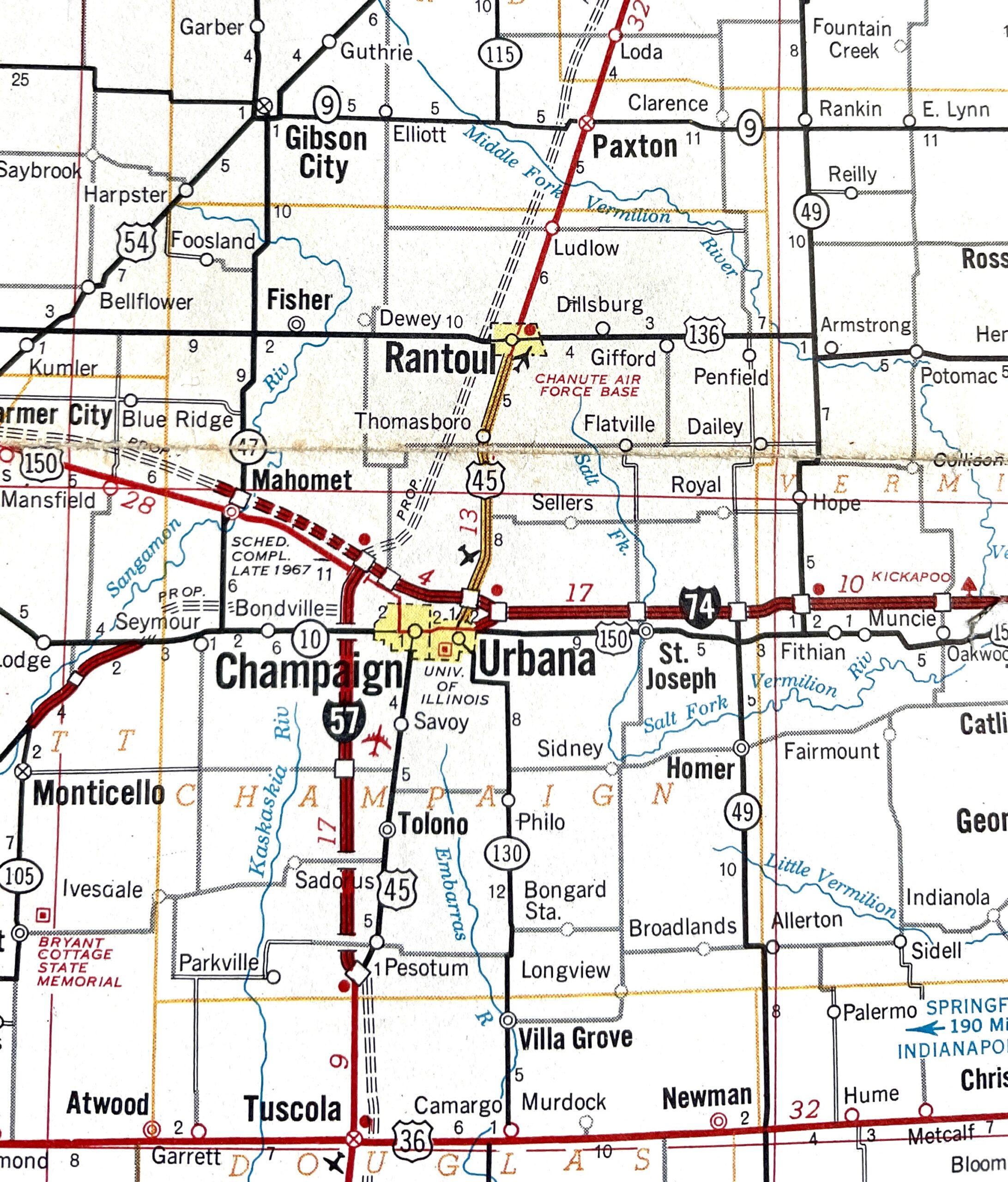
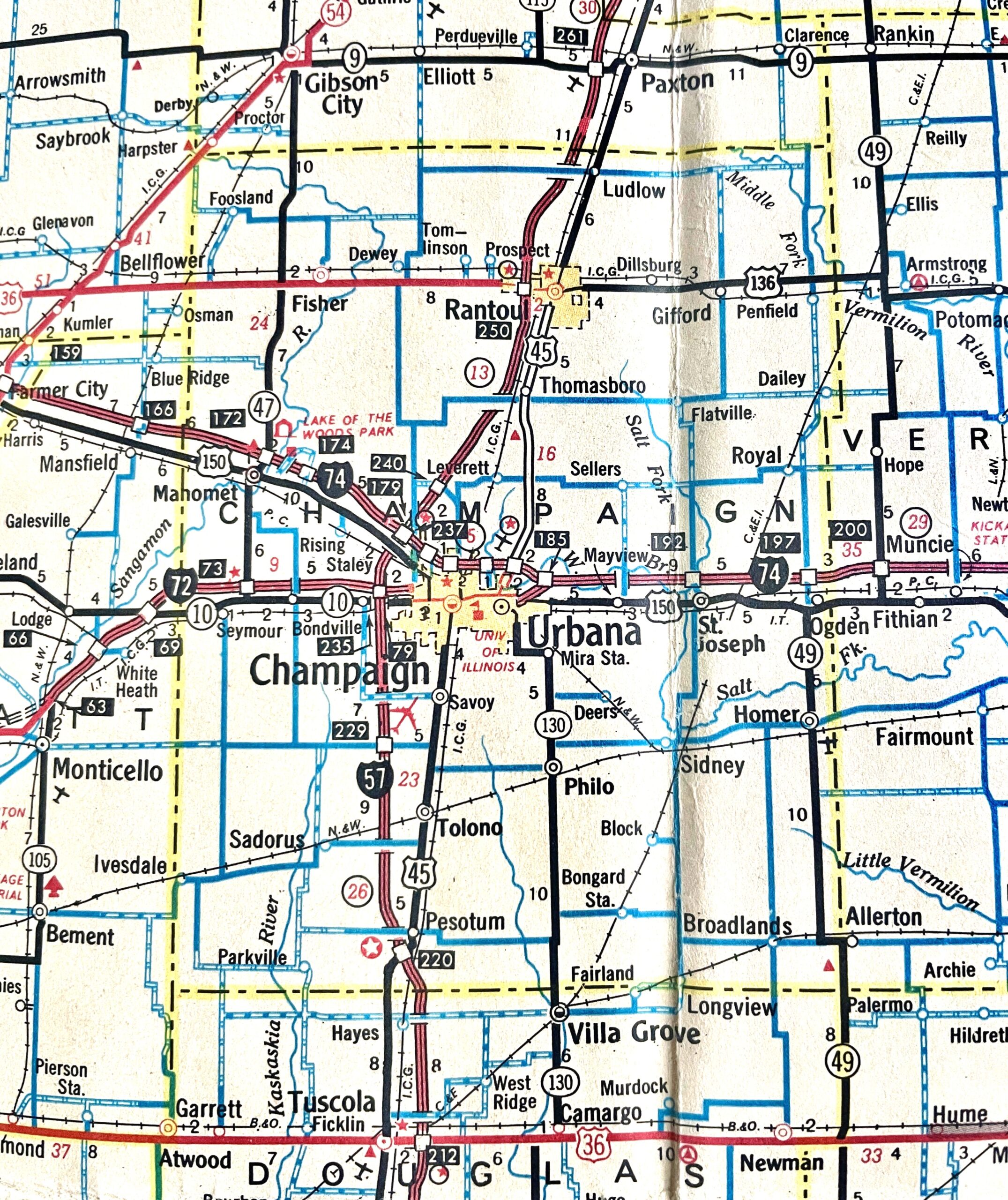
The Waubonsie Trail entered Urbana on east Washington Street on brick pavement that remained intact until the century’s end. It turned north at Pfeffer Road, west on Main through downtown Urbana, followed Green Street through Campustown to Champaign where it met the Egyptian Trail at Neil. From downtown Champaign, it continued west on Church Street, went south on Prospect Avenue, and then headed west out of town on Springfield Road.
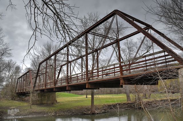
The Diagonal Trail followed the “Big Four” railroad tracks through Ogden and St. Joseph, turned south at Mayview to join the Waubonsie coming west into and through Urbana to downtown Champaign. There it headed north to Bloomington Road, which it followed west into downtown Mahomet after crossing the old iron bridge that still spans the Sangamon River. It left the village on State Street, turned north on what is now Turkey Farm Road and then continued west on the old Bloomington Road (present CR 2300 N).
Even the legendary Pike’s Peak Ocean to Ocean Trail eventually made its way to Champaign-Urbana. An article in the Daily Illini (April 18, 1924) reported that local members of the PPOO association had decided to move the trail from its original alignment (now U. S. 36) northward. It would now arrive in Champaign from the west on Springfield Avenue to Prospect, continue east on University to Sixth, turn south to Green, pass through campus and then on to Urbana, where it then left the twin cities via Main.
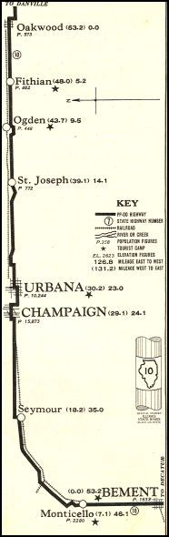
In the mid-1930s, University officials asked the Illinois Department of Transportation to move the highway (now Illinois Route 10) away from campus, and the route was shifted to Springfield Avenue between Neil and Wright.
The legacy of these early auto trails in Champaign County remain in state and federal highways familiar to us today. The Diagonal initially became State Route 39 and then U. S. Route 150, and it inspired the route of Interstate 74. The Waubonsie and Havana-Lincoln-Champaign trails going west out of Champaign eventually were later designated as State Routes 47 and 10 going west to Decatur and Clinton respectively.
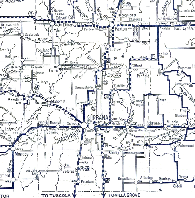
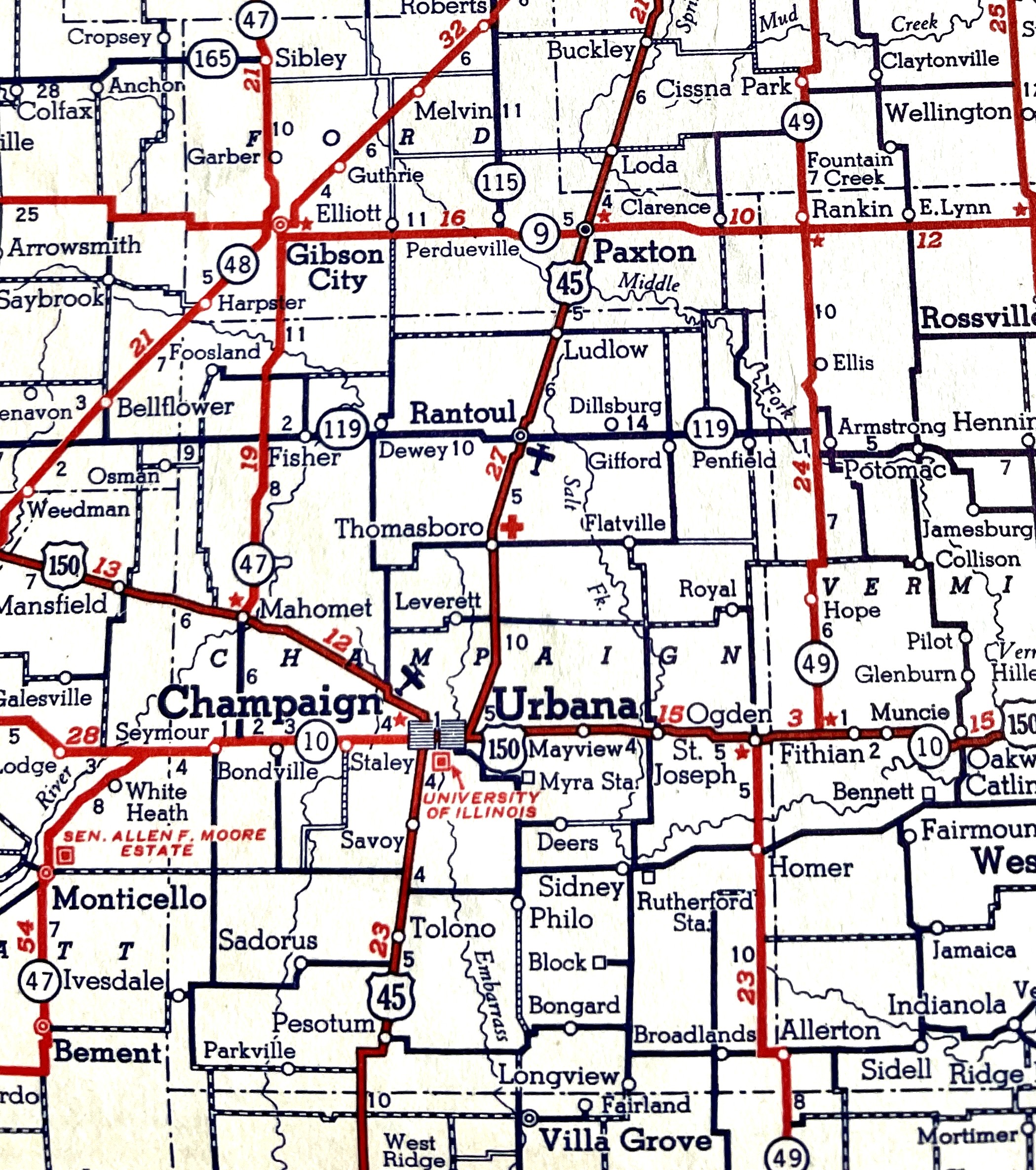
The Egyptian Trail became State Route 25 and then U. S. Route 45 from Chicago to Effingham and ultimately inspired the route of Interstate 57. With this the “Champaign way” once again prevailed over the 25/45 route through Urbana. After I-57 passes west of Champaign and angles north toward Chicago, a present-day driver can leave the interstate at Market Street (Exit 240), go east on Leverett Road, pick up the original Egyptian Trail alignment to Thomasboro and Rantoul, and easily get back on the interstate from U. S. 136. Just for fun, of course, or maybe as a tribute to all the “good roads” enthusiasts who paved the way for the modern road trip.
Sources Consulted for this series:
Articles from the Champaign Daily News, Daily Illini, and Urbana Daily Courier (dates as cited), accessed through the Illinois Digital Newspapers Collection (https://idnc.library.illinois.edu).
Maps from the 1913 Atlas of Champaign County and the County Road Maps Collection at the Champaign County Historical Archives at the Urbana Free Library; and from author’s personal collection.
Iverson A. Lumpkin photo from https://www.findagrave.com/memorial/83752934/iverson-allen-lumpkin
Tom Kacich, “The dirt on C-U’s first highway,” News-Gazette, June 14, 2015.
Laura K. Kennedy, ed., Illinois Highway Improvement Blue Book (Chicago, 1919; accessed at https://libsysdigi.library.illinois.edu/oca/Books2007-07/illinoishighwayi00illiilli/illinoishighwayi00illiilli.pdf).
Brocton Lang, “History of the Illinois Department of Transportation, 1903 – 2013” (https://illinoistransportationhistory.wordpress.com/wp-content/uploads/2012/12/history-of-idot.pdf).
Emily Marsh, “Dirt Roads of Rural America” (https://www.nal.usda.gov/collections/stories/dirt-roads).
Dannel McCollum, Essays on the Historical Geography of Champaign County (Champaign County History Museum, 2005)
Thomasboro Centennial Book (Centennial Committee, 1964)
James R. Wright, The Egyptian Trail in Illinois (The History Press, 2023).